

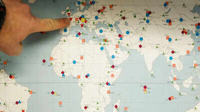
The United Nations General Assembly (UNGA) on Friday endorsed a new world map that more accurately reflects Africa’s actual size, marking the culmination of a Togo-led campaign backed by the African Union and various advocacy groups.The UNGA adopted a resolution titled “Correct The Map”, with 164 member states voting in favour. The United States was the only country to vote against the resolution, while six countries — Serbia, Estonia, Georgia, Lithuania, Moldova and Ukraine — abstained.The campaign urged governments and institutions worldwide to move away from the traditional Mercator projection, which has been widely used since the 16th century, and adopt the Equal Earth projection. Advocates and geographers say the Equal Earth map provides a more accurate representation of the relative size and proportions of continents.Under the Mercator projection, Greenland appears roughly comparable in size to Africa, despite being far smaller. The Equal Earth projection, by contrast, depicts continents in more accurate proportions, showing Africa as about 14 times larger than Greenland.However, the resolution does not prohibit the use of the Mercator projection or mandate its replacement. According to a UN report, it simply encourages governments and institutions to consider using the Equal Earth projection instead.“Maps shape our understanding of the world,” Togo’s foreign minister Robert Dussey was quoted by the UN as saying ahead of the vote. “They guide education, nourish the imagination, and influence collective perceptions.”Africa No Filter, one of the leading groups behind the campaign to promote the new map, welcomed the resolution and called for more widespread use of accurate maps.“We want to see accurate maps in schools, textbooks, newsrooms, businesses and on the digital platforms billions of people use every day,” the organisation said.The Mercator projection was developed by Flemish cartographer Gerardus Mercator to assist European navigators at sea. However, critics argue that the projection significantly distorts the size of landmasses, making regions closer to the poles, such as North America and Greenland, appear much larger while making Africa and South America appear smaller.On the map, Alaska appears to be roughly the same size as Brazil. In reality, Brazil is nearly five times larger. Alaska is about 1.7 million square kilometres, while Brazil is about 8.5 million square kilometres.Antarctica appears massive at the bottom of a Mercator map, stretching out to look like an enormous continent that dominates the bottom of the world. While it is still large, its visual area is heavily exaggerated compared to landmasses near the middle of the map.Introduced in 2018, the Equal Earth projection takes the Earth’s curvature into account and presents continents in proportions that more closely reflect their actual size. In it, Europe appears to shrink, Brazil balloons, and Greenland dramatically diminishes. Africa appears much larger in comparison.
Why India backed resolution
Explaining India’s stand, First Secretary at the Permanent Mission of India to the UN, Raghoo Puri, highlighted that Equal Area projections preserve the relative sizes or areas of continental and territorial landmasses.“This can help address distortions in perceived landmass size that arise from projections designed primarily to preserve other geographic characteristics such as shape, direction, or distance. At the same time, different projections serve different cartographic purposes. No single projection is necessarily appropriate for every application.”“Therefore, we believe it is important for this resolution to remain technological and methodological-neutral. Our delegation supports the language that encourages accurate cartographic representation while allowing countries, institutions and cartographers to determine which projection is most appropriate for their specific needs,” he added.However, Puri clarified that India’s position is limited to the principle of encouraging Equal Area approaches where the objective is to preserve the relative sizes of continental landmasses.(With agency inputs)