
In 2015, tree cover in drylands in Ethiopia was only 1.9%; nine years later, helping old roots regrow has brought forest coverage to more than 22%

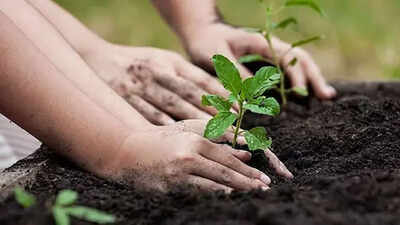
In 2015, tree cover in Ethiopia’s drylands was only 1.9%; nine years later, helping old roots regrow has increased forest coverage to more than 22%.A comprehensive study assessing land restoration in the Kembata Tambaro region of central Ethiopia shows that protecting wild growth and planting new trees can significantly reduce the severe loss of topsoil in the dry, hilly region.The study was published in the scientific journal Scientific Reports by lead author Melese Wondatir Sisay. The survey assesses the real-world impact of the REDD+ investment program, an environmental initiative launched in 2015 with financial support from the Norwegian government. By examining high-detail satellite imagery provided by the International Climate and Forest Initiative in Norway, as well as ground height maps and historical rainfall records, the team mapped land change and soil movement at six pilot trial sites covering more than 107 square kilometers between 2015 and 2024.Three trial sites were restored using Assisted Natural Regeneration, a management strategy that focuses on protecting existing root systems and managing the surrounding land, allowing native shrubs and trees to regenerate naturally without the need for costly nursery planting. Forest cover in these locations will increase from 1.9% in 2015 to 22.18% in 2024. As a result, annual soil loss dropped from 13.19 tonnes per hectare to 9.49 tonnes per hectare over the nine-year assessment period.
Afforestation leads to sharp decrease in topsoil loss
Direct tree planting programs have resulted in a further increase in forest canopy area and a significant reduction in washed topsoil. In three tree-planting pilot areas, new saplings are actively planted on bare or felled land, and the forest coverage rate will expand from 8.5% in 2015 to 34.92% in 2024.Due to severe land damage to these active cultivation sites at the start of the project, initial topsoil losses were very high, at 43.37 tonnes per hectare per year in 2015. By 2024, protective tree cover will help reduce losses to 31.29 tonnes per hectare per year.The findings provide important data for Ethiopia’s national forest development strategy and its climate-resilient green economy policy framework. In the country’s arid highlands, rapid population growth, unpredictable rainfall and heavy farming often result in the loss of 20 to 100 tons of topsoil per hectare per year from steep slopes. This ongoing erosion directly weakens agricultural yields by washing away nutrient-rich soil, destroying agricultural productivity and threatening the food supply of local communities.
Satellite tracking reveals landscape recovery
To accurately track changes in these environments over time, the researchers analyzed clear 4.77-meter resolution satellite photos from Google’s cloud-based mapping software. They divided regional landscapes into seven basic cover types: dense forest, open forest, scrub, cropland, grassland, bare soil, and towns.The satellite mapping results proved highly reliable by checking against 356 real-world ground locations verified with detailed aerial photographs. The overall accuracy of baseline data mapping in 2015 reached 81.4%, and the map accuracy in 2024 will reach 86.79%.To estimate how much soil was actually saved from erosion, the researchers created a computer formula that combined long-term rainfall averages from 1990 to 2024, local ground slope, soil type and plant cover. The standard calculation, known as the Revised Universal Soil Loss Equation model, estimates how different weather and ground factors work together to cause or prevent land scouring. When tested using standard statistical reliability checks, the model demonstrated strong predictive power, with a maximum score of 0.823 out of 1.0.
local geography and climate conditions
The Kembata Tembaro area has complex topography, with high plateaus, deep valleys and rolling hills, with altitudes ranging from 800 to 2,600 meters above sea level. This wide altitude range creates unique local weather bands. However, almost all of the test area (95%) is located in the hot, dry lowlands (known locally as the Kola area) at an altitude below 1,500 meters, with a smaller portion extending into the mid-elevation hills known as Weyna Dega.The REDD+ investment program has established large-scale community forestry projects in 54 regions in Ethiopia, covering the four main administrative regions of Amhara, Central Ethiopia, Sidama and Oromia. The Kembata Tembaro area was selected for this study through purposive sampling to reflect the true physical slope conditions and land types in the area.
Guiding future forest restoration strategies
While planting new seedlings on completely bare ground is still necessary, preserving living root systems and allowing native trees to germinate on their own provides a less expensive, efficient way to restore damaged public lands.The team noted that the findings provide clear real-world evidence that combining natural regeneration methods with active tree planting can successfully protect farmland, stop topsoil loss, and rebuild resilient forests in arid areas facing severe environmental stress.