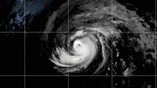
Hurricane Fausto intensifies into Category 2 storm as it moves toward Hawaii; latest track and warnings

Hurricane Fausto has strengthened into a Category 2 storm overhead Pacific OceanForecasters warn that the system could bring wind and rain impacts to Hawaii as it approaches the Hawaiian Islands next week.
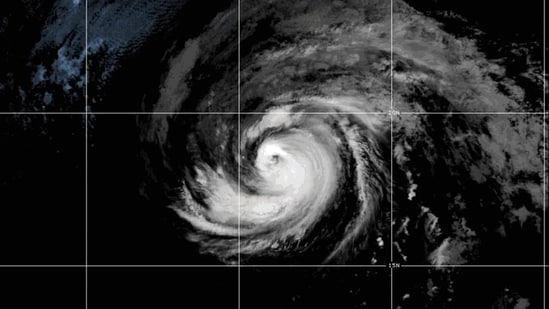
The National Hurricane Center (NHC) in Miami said Friday that the likelihood of impact in Hawaii is increasing, but it’s too early to determine the exact path of the storm or the severity of the conditions it might bring.
“Stakeholders in the Hawaiian Islands should monitor Fausto’s progress,” the hurricane center said in an advisory.
Where is Hurricane Fausto headed?
As of Friday, Hurricane Fausto was far away from any major landmass.
The storm was located about 1,400 miles (2,250 kilometers) west of the southern tip of Mexico’s Baja California peninsula and about 1,500 miles (2,400 kilometers) east of Hilo, Hawaii, according to the National Hurricane Center.
Fausto produced maximum sustained winds of approximately 105 mph (169 km/h), making it a Category 2 hurricane on the Saffir-Simpson scale.
Forecasters said the storm was expected to gradually weaken over the coming days, but officials were continuing to track its movement due to possible impacts to Hawaii.
What warnings have been issued?
The National Hurricane Center has not issued a direct land warning for Hawaii at this stage, but residents and visitors are advised to continue to monitor the latest conditions as the storm approaches.
In addition to Hawaii, Fausto could affect parts of Southern California. The hurricane center warned that waves generated by the storm could create dangerous surf conditions and life-threatening rip currents along parts of the coastline.
Another tropical system in the Pacific, about 600 miles (965 kilometers) south of Zihuatanejo, Mexico, is also being monitored. The system has the potential to develop into a tropical storm and may further intensify, but it does not currently threaten land.
Tropical Storm Bertha weakens after impacting Gulf Coast
While Fausto continues to move across the Pacific, another storm system, Tropical Storm Bertha, has dissipated after bringing severe surf and flooding to parts of the Gulf Coast.
Bertha made two landfalls, affecting southern Louisiana and Texas before weakening on Thursday. The National Hurricane Center said the system dissipated late Thursday, but its remnants continued to pose a flash flooding risk for parts of coastal and southern Texas.
The storm is expected to produce 1 to 3 inches of rainfall, with up to 4 inches in isolated areas. Officials also warned that water levels could continue to rise due to storm surge.
Bertha first moved through southern Louisiana before making a second landfall about 75 miles northeast of Galveston, Texas. The storm was later downgraded from a tropical storm to a depression.
Despite coastal flooding during the initial impact in Louisiana, Bertha reported no fatalities or major damage.
Meanwhile, storm clouds also affected SpaceX’s plans to conduct a Starship test flight from South Texas. The launch was postponed due to weather conditions and later rescheduled.